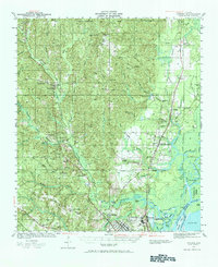
1941 Map of Creola
USGS Topo · Published 1984About this map
Chunchula and Creola anchor this pre-war coastal Alabama landscape, which reveals a complex network of timber, rail, and river industry north of Mobile. The region is defined by the heavy presence of multiple rail lines, including the Gulf Mobile and Ohio Railroad and the Southern Railway, which serviced the river-side settlements and the sprawling Shipyard near the confluence of Chickasaw Creek. The Saint Stephens Base Line cuts across the northern edge of the map, marking the early foundational survey point for the entire state.
Find a feature on this map
83 named features on this map. Tap any name to fly to it.
Don’t see what you’re looking for? This feature index may not catch every label — zoom into the map to look around manually.
Map Details
Editions of this 1941 Creola Map
3 editions found
Other maps of this area

1921 · Fairhope
USGS Topo · 1:62,500

1922 · Mobile
USGS Topo · 1:62,500

1940 · Mobile
USGS Topo · 1:31,680

1940 · Mobile
USGS Topo · 1:62,500

1941 · Chickasaw
USGS Topo · 1:31,680

1941 · Blakeley
USGS Topo · 1:31,680

1941 · Hurley
USGS Topo · 1:62,500

1941 · Bay Minette
USGS Topo · 1:62,500

1941 · Creola
USGS Topo · 1:62,500

1941 · Fairhope
USGS Topo · 1:62,500