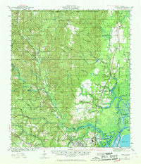
1941 Map of Creola
USGS Topo · Published 1969About this map
The delta environment of the Mobile River and Spanish River dominates this survey, revealing a landscape defined by industrial expansion and rural crossroads just before the mid-century. The Gulf Mobile And Ohio and Southern railroads facilitate the movement of goods between northern timber tracts and the Shipyard facilities near North Mobile. While settlements like Creola and Satsuma line the primary rail corridors, smaller communities such as Chunchula and Mauvilla anchor the western interior. The map illustrates a dense network of local education and faith, evidenced by numerous facilities like Starlight Sch, Saint Stephens Sch, and Golf Crest Ch. Along the meandering Chickasaw Creek, topographic details show the transition from the upland elevations of Sand Hill to the complex waterways of Hells Swamp and Twelvemile Island.
Find a feature on this map
90 named features on this map. Tap any name to fly to it.
Don’t see what you’re looking for? This feature index may not catch every label — zoom into the map to look around manually.
Map Details
Editions of this 1941 Creola Map
3 editions found
Other maps of this area

1921 · Fairhope
USGS Topo · 1:62,500

1922 · Mobile
USGS Topo · 1:62,500

1940 · Mobile
USGS Topo · 1:31,680

1940 · Mobile
USGS Topo · 1:62,500

1941 · Chickasaw
USGS Topo · 1:31,680

1941 · Blakeley
USGS Topo · 1:31,680

1941 · Hurley
USGS Topo · 1:62,500

1941 · Bay Minette
USGS Topo · 1:62,500

1941 · Creola
USGS Topo · 1:62,500

1941 · Fairhope
USGS Topo · 1:62,500