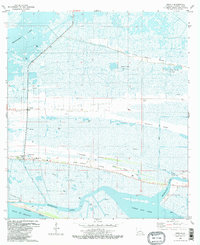
1982 Map of Creole
USGS Topo · Published 1983About this map
The low-lying coastal marshes of Cameron Parish are defined by long, linear ridges known locally as cheniers, which provide the only firm ground for settlements like Creole and Oak Grove. This 1980s landscape is deeply marked by the energy industry, with the Chenier Perdue Gas Field and Eugene Island Gas Field dotting the wetlands with gas wells and storage tanks. These elevations, such as Little Chenier Ridge and Front Ridge, once formed ancient shorelines and remain the primary corridors for transport and habitation above the surrounding wetlands.
Find a feature on this map
29 named features on this map. Tap any name to fly to it.
Don’t see what you’re looking for? This feature index may not catch every label — zoom into the map to look around manually.
Map Details
Editions of this 1982 Creole Map
2 editions found
Other maps of this area

1934 · Lake Misere
USGS Topo · 1:24,000

1934 · Sweet Lake
USGS Topo · 1:24,000

1934 · Grand Bayou
USGS Topo · 1:24,000

1934 · Boudreaux Lake
USGS Topo · 1:24,000

1935 · Sweet Lake
USGS Topo · 1:31,680

1935 · Lake Misere
USGS Topo · 1:31,680

1935 · Boudreaux Lake
USGS Topo · 1:31,680

1935 · Grand Bayou
USGS Topo · 1:31,680

1935 · Bay Labauve
USGS Topo · 1:31,680

1935 · Grand Chenier
USGS Topo · 1:31,680