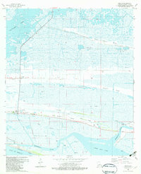
1982 Map of Creole
USGS Topo · Published 1982About this map
Creole and Oak Grove sit at the crossroads of this coastal landscape, situated along the elevated ridges that define the Chenier Plain. The map highlights a complex interplay between the natural marsh environment and industrial development, characterized by extensive gas extraction at the Chenier Perdue Gas Field and East Chenier Perdue Gas Field. The settlement pattern follows the geography of the land, with community life centered around sites like South Cameron High Sch and several family burial grounds, including the Richard Cem and Floodgate Cem.
Find a feature on this map
32 named features on this map. Tap any name to fly to it.
Don’t see what you’re looking for? This feature index may not catch every label — zoom into the map to look around manually.
Map Details
Editions of this 1982 Creole Map
2 editions found
Other maps of this area

1934 · Lake Misere
USGS Topo · 1:24,000

1934 · Sweet Lake
USGS Topo · 1:24,000

1934 · Grand Bayou
USGS Topo · 1:24,000

1934 · Boudreaux Lake
USGS Topo · 1:24,000

1935 · Sweet Lake
USGS Topo · 1:31,680

1935 · Lake Misere
USGS Topo · 1:31,680

1935 · Boudreaux Lake
USGS Topo · 1:31,680

1935 · Grand Bayou
USGS Topo · 1:31,680

1935 · Bay Labauve
USGS Topo · 1:31,680

1935 · Grand Chenier
USGS Topo · 1:31,680