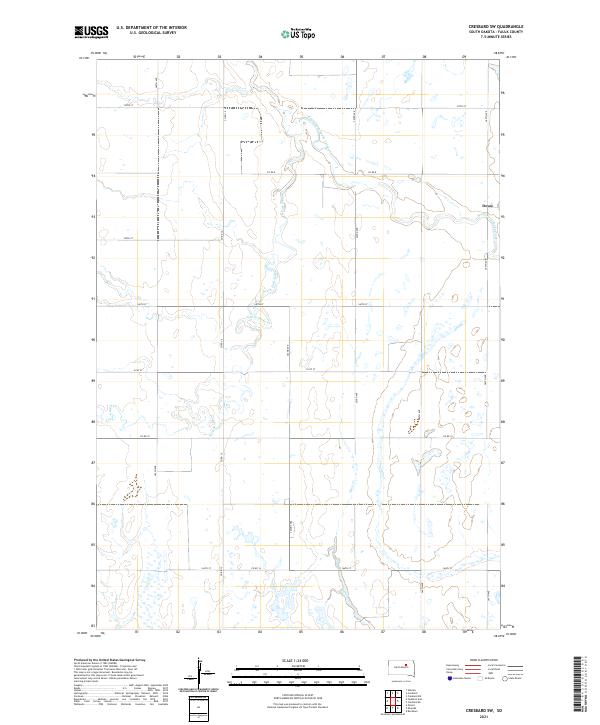
2021 Map of Cresbard SW
USGS Topo · Published 2021About this map
South Fork Snake Creek meanders through the heart of Faulk County, South Dakota, defining the geography of this agricultural region. The small settlement of Devoe sits near the eastern boundary, serving as a localized point of historical interest in an otherwise sparse prairie landscape. The terrain is characterized by numerous small depressions and seasonal wetlands typical of the Glacial Lake Agassiz region, interlaced with a strictly defined grid of section roads like 360th Ave and 160th St. To the south, Dove Cr contributes to the local drainage system, while the larger S Fork Snake Cr winds through the central sections. This map documents a quiet rural area where township lines, including t119n r67w and t118n r68w, organize a landscape dominated by family farmsteads and agricultural persistence.
Find a feature on this map
22 named features on this map. Tap any name to fly to it.
Don’t see what you’re looking for? This feature index may not catch every label — zoom into the map to look around manually.
Map Details
Editions of this 2021 Cresbard SW Map
This is the sole edition of this map. No revisions or reprints were ever made.
Other maps of this area

1899 · Northville
USGS Topo · 1:125,000

1899 · Redfield
USGS Topo · 1:125,000

1951 · Orient
USGS Topo · 1:24,000

1952 · Wecota
USGS Topo · 1:24,000

1952 · Faulkton East
USGS Topo · 1:24,000

1953 · Huron
USGS Topo · 1:250,000

1954 · Aberdeen
USGS Topo · 1:250,000

1954 · Huron
USGS Topo · 1:250,000

1956 · Aberdeen
USGS Topo · 1:250,000

1966 · Cresbard SE
USGS Topo · 1:24,000