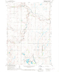
1966 Map of Cresbard SW
USGS Topo · Published 1967About this map
Devoe and the surrounding townships in Faulk County reflect a classic mid-century agricultural landscape defined by the drainage patterns of Snake Creek. The map details the winding course of the South Fork Snake Creek and Dove Creek, which carve through the prairie terrain of Myron, Devoe, and Lafoon townships. This 1966 survey was produced as part of the Interior Department's development program for the Missouri River Basin, capturing the region just as modern land management practices were being codified.
Find a feature on this map
14 named features on this map. Tap any name to fly to it.
Don’t see what you’re looking for? This feature index may not catch every label — zoom into the map to look around manually.
Map Details
Editions of this 1966 Cresbard SW Map
This is the sole edition of this map. No revisions or reprints were ever made.
Other maps of this area

1899 · Northville
USGS Topo · 1:125,000

1899 · Redfield
USGS Topo · 1:125,000

1951 · Orient
USGS Topo · 1:24,000

1952 · Wecota
USGS Topo · 1:24,000

1952 · Faulkton East
USGS Topo · 1:24,000

1953 · Huron
USGS Topo · 1:250,000

1954 · Aberdeen
USGS Topo · 1:250,000

1954 · Huron
USGS Topo · 1:250,000

1956 · Aberdeen
USGS Topo · 1:250,000

1966 · Cresbard SE
USGS Topo · 1:24,000