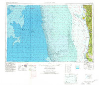
1958 Map of Crescent City
USGS Topo · Published 1978About this map
Crescent City and the extreme northwestern coast of California are depicted here at a transitional moment when military installations and established redwood preserves coexisted with ancient tribal grounds. This survey highlights the complex shoreline of Del Norte County, featuring the Yontocket Indian Village Site north of the city and the specialized Klamath Air Force Station to the south. The mapping of St George Reef and its associated hazards like NW Seal Rock and Whale Rock emphasizes the maritime importance of the region, anchored by the Trinidad Head Light.
Find a feature on this map
59 named features on this map. Tap any name to fly to it.
Don’t see what you’re looking for? This feature index may not catch every label — zoom into the map to look around manually.
Map Details
Editions of this 1958 Crescent City Map
This is the sole edition of this map. No revisions or reprints were ever made.
Other maps of this area

1917 · Kerby
USGS Topo · 1:125,000

1918 · Kerby
USGS Topo · 1:125,000

1922 · Preston Peak
USGS Topo · 1:125,000

1922 · Eureka
USGS Topo · 1:62,500

1922 · Korbel
USGS Topo · 1:62,500

1925 · Hoopa
USGS Topo · 1:125,000

1929 · Crescent City
USGS Topo · 1:125,000

1933 · Eureka
USGS Topo · 1:48,000

1942 · Eureka
USGS Topo · 1:62,500

1945 · Ship Mountain
USGS Topo · 1:62,500