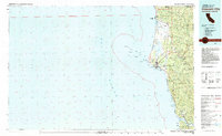
1983 Map of Crescent City
USGS Topo · Published 1983About this map
Crescent City and the rocky Del Norte coastline are documented here in the early 1980s, showcasing a landscape defined by massive redwood preserves and maritime navigation. The coastal reach from Pelican Bay south past the Klamath River reveals the complex offshore hazards of St George Reef, including NW Seal Rock and Whale Rock. Inland, the map traces the intersection of resource extraction and conservation, where the Alta Mine and Copper Creek Mine sit near the borders of the Redwood National Park and Six Rivers National Forest. This era shows the established footprint of McNamara Field and the Lighthouse alongside indigenous lands such as the Resighini Rancheria and Prince I Smith River Rancheria. The transportation network relies on the primary arteries of Highway 101 and 199, connecting small northern settlements like Smith River and Fort Dick to the larger regional hub.
Find a feature on this map
68 named features on this map. Tap any name to fly to it.
Don’t see what you’re looking for? This feature index may not catch every label — zoom into the map to look around manually.
Map Details
Editions of this 1983 Crescent City Map
This is the sole edition of this map. No revisions or reprints were ever made.
Other maps of this area

1917 · Kerby
USGS Topo · 1:125,000

1918 · Kerby
USGS Topo · 1:125,000

1922 · Preston Peak
USGS Topo · 1:125,000

1925 · Hoopa
USGS Topo · 1:125,000

1929 · Crescent City
USGS Topo · 1:125,000

1945 · Ship Mountain
USGS Topo · 1:62,500

1945 · Orick
USGS Topo · 1:62,500

1945 · Kerby
USGS Topo · 1:125,000

1945 · Gasquet
USGS Topo · 1:62,500

1945 · Point St. George
USGS Topo · 1:62,500