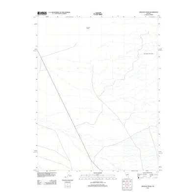
2012 Map of Crescent Dunes
USGS Topo · Published 2012About this map
Crescent Dunes dominates the northern expanse of this High Desert landscape just north of Tonopah, Nevada. Published by the U.S. Geological Survey in 2012, this sheet illustrates the stark transition from the wind-sculpted sand formations of the dunes to the rocky eastern elevations of the San Antonio Mountains. The mapping documents the arid drainage patterns and intermittent washes that define the area's hydrology, alongside a network of roads that service this specific section of Nye County. While the terrain is predominantly open, the juxtaposition of these two distinct geological formations—the massive dunefield and the mountain range—highlights the geographic complexity of the Great Basin region during the early 21st century.
Find a feature on this map
2 named features on this map. Tap any name to fly to it.
Don’t see what you’re looking for? This feature index may not catch every label — zoom into the map to look around manually.
Map Details
Editions of this 2012 Crescent Dunes Map
This is the sole edition of this map. No revisions or reprints were ever made.
Other maps of this area

1907 · Tonopah
USGS Topo · 1:250,000

1908 · Tonopah
USGS Topo · 1:250,000

1956 · Tonopah
USGS Topo · 1:250,000

1959 · Tonopah
USGS Topo · 1:250,000
1960 · Tonopah
USGS Topo · 1:24,000

1961 · Tonopah
USGS Topo · 1:62,500

1961 · Lone Mtn
USGS Topo · 1:62,500

1962 · Tonopah
USGS Topo · 1:250,000

1963 · Baxter Spring
USGS Topo · 1:62,500

1964 · San Antonio Ranch
USGS Topo · 1:62,500