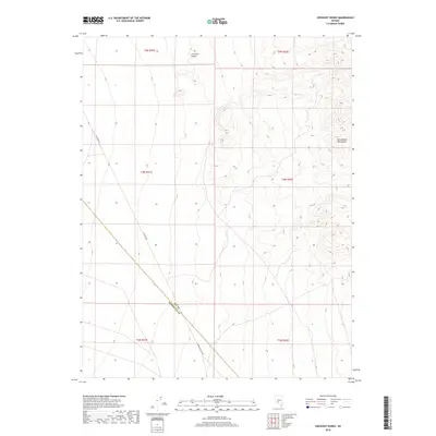
2018 Map of Crescent Dunes
USGS Topo · Published 2018About this map
Crescent Dunes dominate the northern terrain of this high-desert landscape near the border of Nye and Esmeralda counties. The topographical detail captures the transition from these distinctive sand formations to the eastern slopes of the San Antonio Mountains. The area is defined by sparse infrastructure, with transportation limited to historic utility corridors such as Poleline Rd and Gabbs Pole Line Rd, which trace diagonal paths across the open basin. This survey provides a precise look at the township and range divisions, including t4n r41e and t5n r42e, showing how the public land survey system organizes this arid expanse of central Nevada.
Find a feature on this map
11 named features on this map. Tap any name to fly to it.
Don’t see what you’re looking for? This feature index may not catch every label — zoom into the map to look around manually.
Map Details
Editions of this 2018 Crescent Dunes Map
This is the sole edition of this map. No revisions or reprints were ever made.
Other maps of this area

1907 · Tonopah
USGS Topo · 1:250,000

1908 · Tonopah
USGS Topo · 1:250,000

1956 · Tonopah
USGS Topo · 1:250,000

1959 · Tonopah
USGS Topo · 1:250,000
1960 · Tonopah
USGS Topo · 1:24,000

1961 · Tonopah
USGS Topo · 1:62,500

1961 · Lone Mtn
USGS Topo · 1:62,500

1962 · Tonopah
USGS Topo · 1:250,000

1963 · Baxter Spring
USGS Topo · 1:62,500

1964 · San Antonio Ranch
USGS Topo · 1:62,500