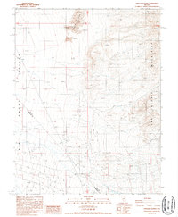
1987 Map of Crescent Dunes
USGS Topo · Published 1987About this map
The Sand Dunes of the Big Smoky Valley dominate this high-desert landscape in the late 1980s. This region, straddling the line between Nye Co and Esmeralda Co, is defined by its arid terrain and extensive mining activity. Numerous Prospects are scattered across the slopes of the San Antonio Mountains, indicating a period of active mineral exploration or historic claims. The infrastructure is minimal, characterized by a network of 4wd tracks that provide the only access through the valley and into the mountain canyons.
Find a feature on this map
10 named features on this map. Tap any name to fly to it.
Don’t see what you’re looking for? This feature index may not catch every label — zoom into the map to look around manually.
Map Details
Editions of this 1987 Crescent Dunes Map
This is the sole edition of this map. No revisions or reprints were ever made.
Other maps of this area

1907 · Tonopah
USGS Topo · 1:250,000

1908 · Tonopah
USGS Topo · 1:250,000

1956 · Tonopah
USGS Topo · 1:250,000

1959 · Tonopah
USGS Topo · 1:250,000
1960 · Tonopah
USGS Topo · 1:24,000

1961 · Tonopah
USGS Topo · 1:62,500

1961 · Lone Mtn
USGS Topo · 1:62,500

1962 · Tonopah
USGS Topo · 1:250,000

1963 · Baxter Spring
USGS Topo · 1:62,500

1964 · San Antonio Ranch
USGS Topo · 1:62,500