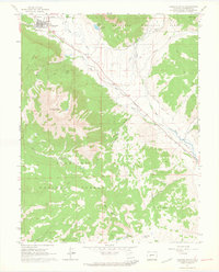
1961 Map of Crested Butte
USGS Topo · Published 1964About this map
Crested Butte serves as the focal point of this high-altitude survey, sitting at the junction of Coal Creek and the Slate River. This map reveals a landscape defined by its mining heritage and water management, featuring the Bulkley Mine (Site) and an extensive network of irrigation through the Verzuh Ditch and Young Ditch. The transition from heavy industry to mountain recreation is visible in the presence of Skyland Camp and the persistent Old Railroad Grade that winds through the valley floor. Dominant peaks like Whetstone Mtn and Red Mountain tower over the Gunnison National Forest, while family-named landmarks like Cold Spring Ranch and Strand Hill provide specific points of interest for genealogists tracing local land ownership. Numerous pack trails and jeep trails crisscross the terrain, connecting remote drainage areas like Baxter Gulch and Squaw Gulch.
Find a feature on this map
29 named features on this map. Tap any name to fly to it.
Don’t see what you’re looking for? This feature index may not catch every label — zoom into the map to look around manually.
Map Details
Editions of this 1961 Crested Butte Map
4 editions found
Other maps of this area

1888 · Crested Butte
USGS Topo · 1:62,500

1888 · Anthracite
USGS Topo · 1:62,500

1889 · Crested Butte
USGS Topo · 1:62,500

1889 · Anthracite
USGS Topo · 1:62,500

1893 · Anthracite
USGS Topo · 1:62,500

1893 · Crested Butte
USGS Topo · 1:62,500

1894 · Anthracite
USGS Topo · 1:62,500

1956 · Montrose
USGS Topo · 1:250,000

1959 · Montrose
USGS Topo · 1:250,000

1960 · Montrose
USGS Topo · 1:250,000