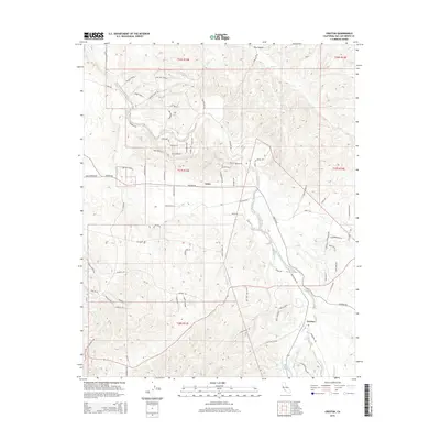
2015 Map of Creston
USGS Topo · Published 2015About this map
Creston and the settlement of Linne anchor this agricultural landscape in San Luis Obispo County, where the terrain is defined by the complex drainage network of Huerhuero Cr. The map shows a transition from the lower creek beds to the higher elevations of Melody Mtn, with a distinct grid of ranching and residential development marked by long-standing road names like Dresser Ranch Pl and Eagle Oak Ranch Way. The hydrography is notably seasonal, featuring numerous ephemeral watercourses such as Dry Canyon and the W Br Huerhuero Cr. This 2015 survey provides a clear view of the rural-residential growth patterns in the El Pomar area, showing how modern properties align with traditional township and range lines like t27s r13e. Local history researchers will find the specific road alignments, such as Neal Springs Rd and Stagecoach Rd, useful for tracing the evolution of regional transportation.
Find a feature on this map
81 named features on this map. Tap any name to fly to it.
Don’t see what you’re looking for? This feature index may not catch every label — zoom into the map to look around manually.
Map Details
Editions of this 2015 Creston Map
This is the sole edition of this map. No revisions or reprints were ever made.
Other maps of this area

1897 · San Luis Obispo
USGS Topo · 1:62,500

1900 · San Luis
USGS Topo · 1:125,000

1914 · Cholame
USGS Topo · 1:125,000

1915 · Cholame
USGS Topo · 1:125,000

1917 · Cholame
USGS Topo · 1:125,000

1919 · Paso Robles
USGS Topo · 1:62,500

1922 · Pozo
USGS Topo · 1:62,500

1942 · San Luis Obispo
USGS Topo · 1:62,500

1943 · Shandon
USGS Topo · 1:31,680

1943 · Paso Robles
USGS Topo · 1:62,500