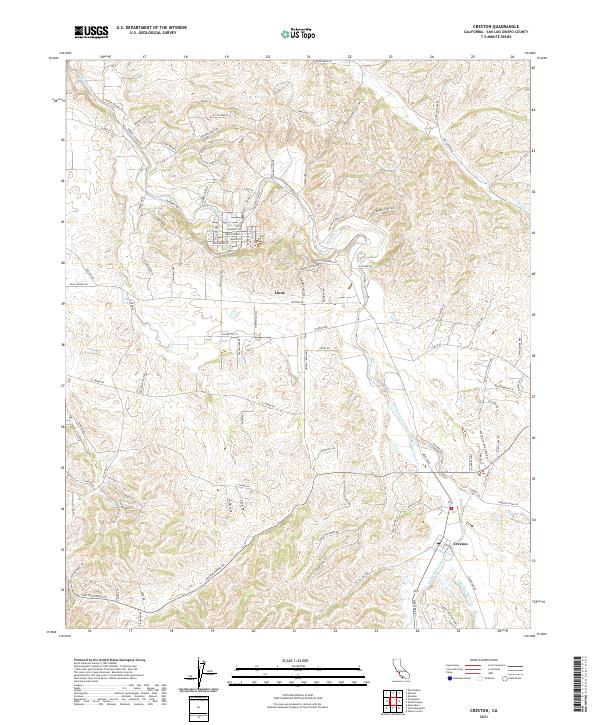
2021 Map of Creston
USGS Topo · Published 2021About this map
Creston and the surrounding ranch lands of San Luis Obispo County are defined by the intricate drainage systems of Huerhuero Cr, including its West, Middle, and East branches. This 2021 survey illustrates a modern landscape still rooted in its agricultural and rural heritage, where small settlements like Linne sit at the intersection of long-established thoroughfares such as Creston Rd and Geneseo Rd. The topography rises toward Melody Mountain and several named canyons, such as Ground Squirrel Hollow, while the surrounding sections are carved into distinctive parcels of the Public Land Survey System.
Find a feature on this map
109 named features on this map. Tap any name to fly to it.
Don’t see what you’re looking for? This feature index may not catch every label — zoom into the map to look around manually.
Map Details
Editions of this 2021 Creston Map
This is the sole edition of this map. No revisions or reprints were ever made.
Other maps of this area

1897 · San Luis Obispo
USGS Topo · 1:62,500

1900 · San Luis
USGS Topo · 1:125,000

1914 · Cholame
USGS Topo · 1:125,000

1915 · Cholame
USGS Topo · 1:125,000

1917 · Cholame
USGS Topo · 1:125,000

1919 · Paso Robles
USGS Topo · 1:62,500

1922 · Pozo
USGS Topo · 1:62,500

1942 · San Luis Obispo
USGS Topo · 1:62,500

1943 · Shandon
USGS Topo · 1:31,680

1943 · Paso Robles
USGS Topo · 1:62,500