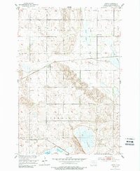
1952 Map of Crete
USGS Topo · Published 1988About this map
Crete and Hample serve as the primary rail-connected hubs on this prairie landscape, situated where the Northern Pacific and the Minneapolis St Paul and Sault Ste Marie railroads intersect the open wetlands of Sargent County. The terrain is defined by a series of significant depressions and water bodies, most notably Bruns Slough, Big Slough, and Dill Slough, which dominate the eastern and southern portions of the sheet. In the south, the shoreline of Lake Taayer borders the settlement at Hample.
Find a feature on this map
15 named features on this map. Tap any name to fly to it.
Don’t see what you’re looking for? This feature index may not catch every label — zoom into the map to look around manually.
Map Details
Editions of this 1952 Crete Map
2 editions found
Other maps of this area

1894 · Oakes
USGS Topo · 1:62,500

1895 · Lamoure
USGS Topo · 1:125,000

1918 · La Moure
USGS Topo · 1:125,000

1952 · Oakes
USGS Topo · 1:24,000

1952 · Crete
USGS Topo · 1:24,000

1953 · Jamestown
USGS Topo · 1:250,000

1953 · Fargo
USGS Topo · 1:250,000
1955 · Oakes SE
USGS Topo · 1:24,000

1956 · Fargo
USGS Topo · 1:250,000

1956 · Jamestown
USGS Topo · 1:250,000