
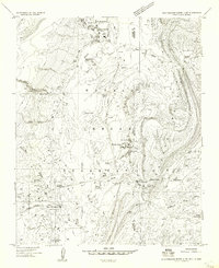
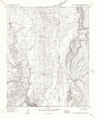
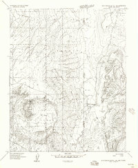
1982 Map of Crevasse Canyon
USGS Topo · Published 1983About this map
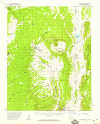
The Navajo Indian Reservation landscape is defined by the high-elevation transition between the Chuska Mountains and the Manuelito Plateau in McKinley County. This 1970s-era field check reveals a terrain carved by numerous seasonal drainages, including the Crevasse Canyon system and the branching headwaters of the North Fork Catron Wash. The map records specific points of human activity and resource extraction, notably the Lone Pine Cemetery and localized Coal deposits.
Find a feature on this map
12 named features on this map. Tap any name to fly to it.
Don’t see what you’re looking for? This feature index may not catch every label — zoom into the map to look around manually.
Map Details
Editions of this 1982 Crevasse Canyon Map
This is the sole edition of this map. No revisions or reprints were ever made.
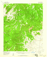
Other maps of this area

1886 · Wingate
USGS Topo · 1:250,000

1886 · Fort Defiance
USGS Topo · 1:250,000

1892 · Fort Defiance
USGS Topo · 1:250,000

1892 · Wingate
USGS Topo · 1:250,000

1954 · Gallup
USGS Topo · 1:250,000
1955 · Zith-Tusayan Butte 4 NE
USGS Topo · 1:24,000
1955 · Zith-Tusayan Butte 1 SE
USGS Topo · 1:24,000
1955 · Zith-Tusayan Butte 1 NE
USGS Topo · 1:24,000
1955 · Tohatchi
USGS Topo · 1:62,500
1955 · Buell Park
USGS Topo · 1:62,500