
1955 Map of Tohatchi
USGS Topo · Published 1959About this map
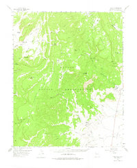
Tohatchi sits at the edge of the Tohatchi Flats within the Navajo Indian Reservation, serving as a focal point for the complex drainage systems of the Chuska Mountains. In the mid-1950s, the landscape was defined by sharp elevation shifts between the high Manuelito Plateau and the deeply carved watercourses of Crevasse Canyon and Figueredo Wash. The presence of Mexican Springs and the nearby Cem suggest established community life alongside critical resource points like Squirrel Springs. Distinctive geologic formations including Cleopatras Needle and Venus Needle rise in the northwest, while Chuska Peak and the Tohatchi Lookout emphasize the strategic vantage points used for monitoring this arid expanse. A network of washes, such as Muddy Wash and Tohdildonih Wash, illustrates the seasonal hydrology that governed movement across the plateau before modernized infrastructure reached the region.
Find a feature on this map
43 named features on this map. Tap any name to fly to it.
Don’t see what you’re looking for? This feature index may not catch every label — zoom into the map to look around manually.
Map Details
Editions of this 1955 Tohatchi Map
2 editions found
Other maps of this area

1886 · Wingate
USGS Topo · 1:250,000

1886 · Fort Defiance
USGS Topo · 1:250,000

1889 · Chaco
USGS Topo · 1:250,000

1892 · Fort Defiance
USGS Topo · 1:250,000

1892 · Wingate
USGS Topo · 1:250,000

1892 · Chaco
USGS Topo · 1:250,000

1892 · Canyon De Chelly
USGS Topo · 1:250,000

1954 · Shiprock
USGS Topo · 1:250,000

1954 · Gallup
USGS Topo · 1:250,000

1955 · Zith-Tusayan Butte 4 NE
USGS Topo · 1:24,000
Featured Places
- Fort Defiance Agency
- Tohatchi, Fort Defiance Agency
- Mexican Springs, Fort Defiance Agency
- McKinley County, NM
- United States