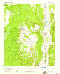
1955 Map of Buell Park
USGS Topo · Published 1959About this map
Fort Defiance and the timber-focused settlement at Sawmill anchor this mid-century topographic record of the Navajo Nation interior. The landscape is defined by the high elevations of the Chuska Mountains and the distinct volcanic feature of Buell Park, a nearly circular depression surrounded by landmarks like Peridot Ridge and Sterrett Mesa. Surveyed just after the war years, the map reveals a network of primitive infrastructure, including a Jeep Trail and a Pipeline cutting across the high desert terrain. Local water sources are meticulously documented, from Tokezje Spring to the seasonal flow of Bonito Creek, reflecting their vital importance to the high plateau economy. Natural landmarks like Fluted Rock Lookout and Piney Hill Lookout provide orientation across the expanse of the Navajo Indian Reservation, while the northeastern corner shows the jagged breaks of Red Valley and the rising slopes of Zilditloi Mtn.
Find a feature on this map
40 named features on this map. Tap any name to fly to it.
Don’t see what you’re looking for? This feature index may not catch every label — zoom into the map to look around manually.
Map Details
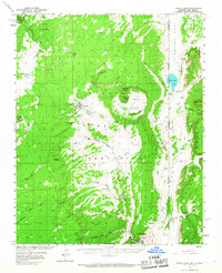
Editions of this 1955 Buell Park Map
2 editions found
Other maps of this area

1886 · Wingate
USGS Topo · 1:250,000

1886 · Fort Defiance
USGS Topo · 1:250,000

1889 · Chaco
USGS Topo · 1:250,000

1892 · Fort Defiance
USGS Topo · 1:250,000

1892 · Wingate
USGS Topo · 1:250,000

1892 · Chaco
USGS Topo · 1:250,000

1892 · Canyon De Chelly
USGS Topo · 1:250,000

1954 · Shiprock
USGS Topo · 1:250,000

1954 · Gallup
USGS Topo · 1:250,000

1955 · Zith-Tusayan Butte 2 SE
USGS Topo · 1:24,000
Featured Places
- Chinle Agency, AZ
- Fort Defiance Agency
- Sawmill, Fort Defiance Agency
- Navajo, Fort Defiance Agency
- McKinley County, NM