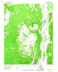
1955 Map of Buell Park
USGS Topo · Published 1967About this map
The Navajo Indian Reservation landscape is anchored here by the dramatic geology of Buell Park and the high peaks of the Huska Mountains. In the mid-1950s, the community of Sawmill served as a key local center, complete with its own Cem and water infrastructure, while Fort Defiance sat near the southern border at the junction of Canyon Bonito. The map captures a high-desert environment defined by life-sustaining water sources like Beehbito Spring, Tohnalchai Spring, and Fluted Rock Lake. Cattle and sheep trails likely frequented the many washes, including Tainchoze Meadow Wash and Black Creek, while early roads were often limited to a simple Jeep Trail. To the northeast, the border between Apache County and McKinley County marks the transition from Arizona into New Mexico, passing through the colorful terrain of Red Valley.
Find a feature on this map
45 named features on this map. Tap any name to fly to it.
Don’t see what you’re looking for? This feature index may not catch every label — zoom into the map to look around manually.
Map Details
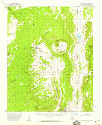
Editions of this 1955 Buell Park Map
2 editions found
Other maps of this area

1886 · Wingate
USGS Topo · 1:250,000

1886 · Fort Defiance
USGS Topo · 1:250,000

1889 · Chaco
USGS Topo · 1:250,000

1892 · Fort Defiance
USGS Topo · 1:250,000

1892 · Wingate
USGS Topo · 1:250,000

1892 · Chaco
USGS Topo · 1:250,000

1892 · Canyon De Chelly
USGS Topo · 1:250,000

1954 · Shiprock
USGS Topo · 1:250,000

1954 · Gallup
USGS Topo · 1:250,000

1955 · Zith-Tusayan Butte 2 SE
USGS Topo · 1:24,000
Featured Places
- Chinle Agency, AZ
- Fort Defiance Agency
- Sawmill, Fort Defiance Agency
- Navajo, Fort Defiance Agency
- McKinley County, NM