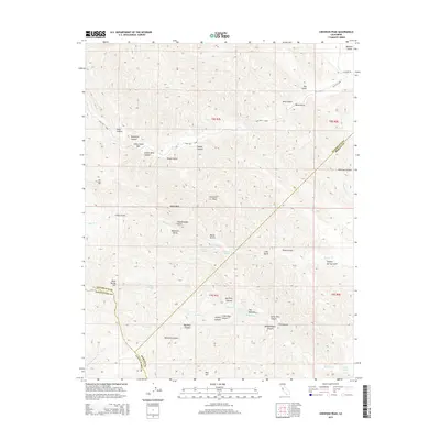
2015 Map of Crevison Peak
USGS Topo · Published 2015About this map
Crevison Peak stands as the central high point of this landscape where the boundaries of Santa Clara, Stanislaus, and Merced counties converge. The terrain is defined by a dense network of steep drainages, including Long Canyon, Sycamore Canyon, and Indian Wells Canyon, which flow into larger systems like Garzas Cr and Romero Cr. This map reveals a complex topography of deep gulches and flats, such as China Cabin Flat and Rough Gulch, illustrating the difficult passage through the Diablo Range. Small bodies of water and perennial sources, including Bass Lake, Tule Lake, and McDowell Spring, provide critical points of interest in this largely undeveloped area. The presence of features like Hawk Rock and The Narrows suggests a landscape of significant geologic relief, while Blue Hill Gdns indicates localized land use amidst the canyons.
Find a feature on this map
54 named features on this map. Tap any name to fly to it.
Don’t see what you’re looking for? This feature index may not catch every label — zoom into the map to look around manually.
Map Details
Editions of this 2015 Crevison Peak Map
This is the sole edition of this map. No revisions or reprints were ever made.
Other maps of this area

1917 · Newman
USGS Topo · 1:31,680

1919 · Orestimba
USGS Topo · 1:62,500

1919 · Orestimba Creek
USGS Topo · 1:31,680

1920 · Pacheco Pass
USGS Topo · 1:62,500

1921 · Gilroy Hot Springs
USGS Topo · 1:62,500

1922 · San Luis Creek
USGS Topo · 1:31,680

1922 · Howard Ranch
USGS Topo · 1:31,680

1938 · Mt. Boardman
USGS Topo · 1:62,500

1939 · Gilroy Hot Springs
USGS Topo · 1:62,500

1940 · Gilroy Hot Springs
USGS Topo · 1:62,500