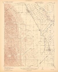
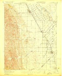
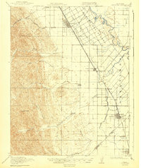
1919 Map of Orestimba
USGS Topo · Published 1919About this map
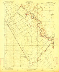
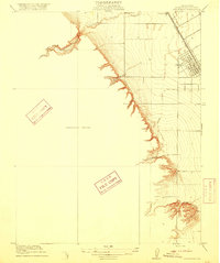
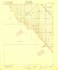
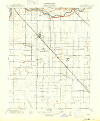
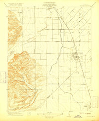
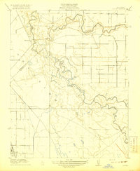
Patterson and Newman anchor this landscape where the San Joaquin Valley's western foothills meet the intensive irrigation systems of the early twentieth century. The map illustrates a transition from the elevated peaks of Orestimba Pk and deep canyons like Puerto Canyon to the highly engineered plains of the Rancho Del Puerto. This area was undergoing a radical transformation as the San Joaquin and Kings River Canal and Irrigation Company and a network of laterals, from Lateral A to Lateral J, carved the land into productive farm plots. Small rural hubs and education centers like Vanormer, Haight School, and Orestimba School are scattered along the western edge of the valley floor, while the Stimba Pumping Station and the Southern Pacific railroad line through Crows Landing signify the industrial infrastructure necessary to sustain this agricultural corridor near the San Joaquin River.
Find a feature on this map
38 named features on this map. Tap any name to fly to it.
Don’t see what you’re looking for? This feature index may not catch every label — zoom into the map to look around manually.
Map Details
Editions of this 1919 Orestimba Map
3 editions found
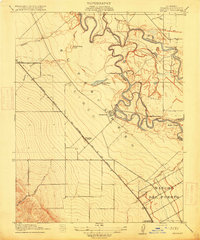
Other maps of this area

1913 · Romain
USGS Topo · 1:31,680

1915 · Westport
USGS Topo · 1:31,680
1915 · Westley
USGS Topo · 1:31,680

1916 · Mitchell School
USGS Topo · 1:31,680
1916 · Crows Landing
USGS Topo · 1:31,680
1916 · Patterson
USGS Topo · 1:31,680
1916 · Romain
USGS Topo · 1:31,680
1916 · Ceres
USGS Topo · 1:31,680
1917 · Newman
USGS Topo · 1:31,680
1918 · Gustine
USGS Topo · 1:31,680