1916 Map of Patterson
USGS Topo · Published 1916About this map
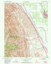
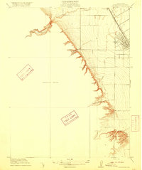
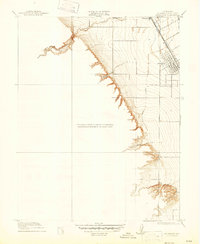
Patterson emerges as a developing agricultural hub in the San Joaquin Valley on this 1916 preliminary edition survey. The map captures the town's early grid system and its critical connection to the Southern Pacific railroad, which runs northwest toward Vanormer. To the west, the landscape shifts abruptly from flat valley floor to the dramatic incisions of the Diablo Range foothills. Deep drainages like Puerto Canyon and Black Gulch cut through the rising terrain, while Puerto Creek and Salado Creek flow toward the cultivated fields below. This document is a cooperation between the Department of the Interior and the State of California, recording a specific moment when rural education centers like Haight School served the growing farming community before more modern irrigation and infrastructure reshaped the Stanislaus County landscape.
Find a feature on this map
9 named features on this map. Tap any name to fly to it.
Don’t see what you’re looking for? This feature index may not catch every label — zoom into the map to look around manually.
Map Details
Editions of this 1916 Patterson Map
3 editions found

Historical Maps of Patterson Through Time
6 maps found