1916 Map of Patterson
USGS Topo · Published 1920About this map
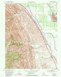
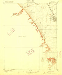
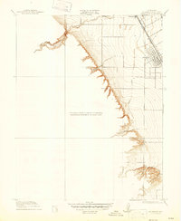
The Patterson townsite emerges as a planned grid along the Southern Pacific railroad during this 1913 survey period. This area of Stanislaus County reveals a sharp transition from the flat agricultural valley floor to the intricately carved topography of the Diablo Range foothills. The landscape is defined by drainage patterns where seasonal waterways like Salado Creek and Puerto Creek exit the uplands. In the north, Haight School and the settlement of Vanormer mark the established rural community. To the west, the terrain becomes increasingly complex as it rises into Puerto Canyon and the sharply etched ravines of Black Gulch, showcasing the dramatic contrast between the irrigated valley lands and the elevated, uncultivated western slopes.
Find a feature on this map
8 named features on this map. Tap any name to fly to it.
Don’t see what you’re looking for? This feature index may not catch every label — zoom into the map to look around manually.
Map Details
Editions of this 1916 Patterson Map
3 editions found
Historical Maps of Patterson Through Time
6 maps found