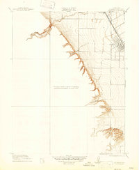
1916 Map of Patterson
USGS Topo · Published 1947About this map
The planned irrigation settlement of Patterson is the central focus of this 1913 survey, showing the town's distinctive radial street design as it emerged in the early twentieth century. Situated along the Southern Pacific railroad line, the town serves as a gateway between the flat agricultural valley and the sharply rising Coast Range foothills to the west. The transition from the valley floor to the upland terrain is marked by intricate contour lines defining features like Puerto Canyon and Black Gulch.
Find a feature on this map
9 named features on this map. Tap any name to fly to it.
Don’t see what you’re looking for? This feature index may not catch every label — zoom into the map to look around manually.
Map Details
Editions of this 1916 Patterson Map
3 editions found
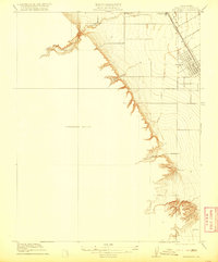
Other maps of this area

1913 · Romain
USGS Topo · 1:31,680

1915 · Westport
USGS Topo · 1:31,680

1915 · Westley
USGS Topo · 1:31,680

1916 · Crows Landing
USGS Topo · 1:31,680

1916 · Patterson
USGS Topo · 1:31,680

1916 · Romain
USGS Topo · 1:31,680

1917 · Newman
USGS Topo · 1:31,680

1919 · Orestimba
USGS Topo · 1:62,500

1919 · Orestimba Creek
USGS Topo · 1:31,680

1922 · Carbona
USGS Topo · 1:62,500