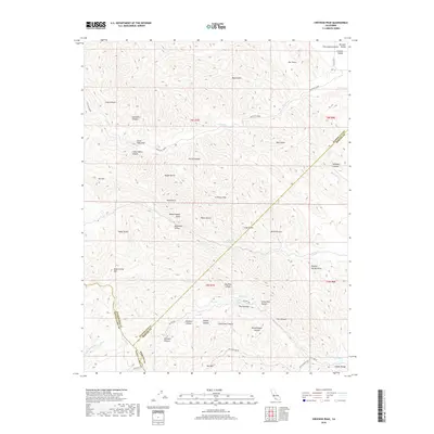
2018 Map of Crevison Peak
USGS Topo · Published 2018About this map
Crevison Peak rises above a landscape defined by sharp elevation changes and deep drainages along the borders of Santa Clara, Stanislaus, and Merced counties. The topography is etched by numerous gulches and canyons, including Sycamore Canyon, Parnell Canyon, and Big Pine Canyon. Water sources such as Eagle Spring, Big Spring, and Reeves Spring appear as vital points in this arid terrain, feeding into seasonal watercourses like Garzas Cr and Mustang Cr. Evidence of early cattle ranching or settlement is found at China Cabin Flat and along the historic Blue Hill Grade. The map details a transition from the higher peaks toward the San Joaquin Valley, with landmarks like Hawk Rock and The Narrows marking the difficult terrain that historically funneled travel through this section of the Diablo Range.
Find a feature on this map
60 named features on this map. Tap any name to fly to it.
Don’t see what you’re looking for? This feature index may not catch every label — zoom into the map to look around manually.
Map Details
Editions of this 2018 Crevison Peak Map
This is the sole edition of this map. No revisions or reprints were ever made.
Other maps of this area

1917 · Newman
USGS Topo · 1:31,680

1919 · Orestimba
USGS Topo · 1:62,500

1919 · Orestimba Creek
USGS Topo · 1:31,680

1920 · Pacheco Pass
USGS Topo · 1:62,500

1921 · Gilroy Hot Springs
USGS Topo · 1:62,500

1922 · San Luis Creek
USGS Topo · 1:31,680

1922 · Howard Ranch
USGS Topo · 1:31,680

1938 · Mt. Boardman
USGS Topo · 1:62,500

1939 · Gilroy Hot Springs
USGS Topo · 1:62,500

1940 · Gilroy Hot Springs
USGS Topo · 1:62,500