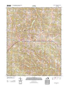
2013 Map of Crewe West
USGS Topo · Published 2013About this map
Burkeville serves as the central hub of this Southside Virginia landscape, where the convergence of major transit corridors defines the local geography. The settlement of Crewe occupies the eastern edge, connected by a network of roads and rail paths that pass through smaller locales like Mutt and Jennings Ordinary. The terrain is deeply etched by a complex drainage system, including the Little Nottoway River in the south and numerous creeks such as Lazaretto Cr and Carys Cr that flow through the timbered tracts and agricultural fields. To the west, Burkes Tavern stands near the headwaters of Saylers Cr, marking a point of long-standing local significance. This map documents a modern view of a region defined by its rural intersections and the persistent naming of its waterways and old crossroads settlements like Oliveville.
Find a feature on this map
89 named features on this map. Tap any name to fly to it.
Don’t see what you’re looking for? This feature index may not catch every label — zoom into the map to look around manually.
Map Details
Editions of this 2013 Crewe West Map
This is the sole edition of this map. No revisions or reprints were ever made.
Other maps of this area

1891 · Farmville
USGS Topo · 1:125,000

1893 · Farmville
USGS Topo · 1:125,000

1947 · Roanoke
USGS Topo · 1:250,000

1958 · Farmville
USGS Topo · 1:62,500

1958 · Jetersville
USGS Topo · 1:62,500

1958 · Crewe
USGS Topo · 1:62,500

1958 · Keysville
USGS Topo · 1:62,500

1959 · Roanoke
USGS Topo · 1:250,000

1963 · Roanoke
USGS Topo · 1:250,000
1968 · Deatonville
USGS Topo · 1:24,000