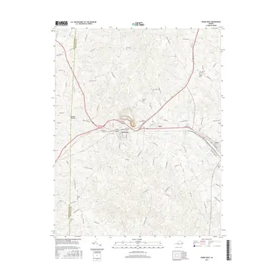
2016 Map of Crewe West
USGS Topo · Published 2016About this map
Burkeville and the nearby western edge of Crewe define this Piedmont landscape, where the transport corridor of U.S. Route 460 and the Norfolk Southern railroad tracks intersect. The map records a dense network of local family history through numerous small burial grounds, including Sunset Hill Cem and Olive Branch Cem near the town center, and more isolated sites like Thomas Cem and Vaughns Cem scattered across the countryside.
Find a feature on this map
90 named features on this map. Tap any name to fly to it.
Don’t see what you’re looking for? This feature index may not catch every label — zoom into the map to look around manually.
Map Details
Editions of this 2016 Crewe West Map
This is the sole edition of this map. No revisions or reprints were ever made.
Other maps of this area

1891 · Farmville
USGS Topo · 1:125,000

1893 · Farmville
USGS Topo · 1:125,000

1947 · Roanoke
USGS Topo · 1:250,000

1958 · Farmville
USGS Topo · 1:62,500

1958 · Jetersville
USGS Topo · 1:62,500

1958 · Crewe
USGS Topo · 1:62,500

1958 · Keysville
USGS Topo · 1:62,500

1959 · Roanoke
USGS Topo · 1:250,000

1963 · Roanoke
USGS Topo · 1:250,000
1968 · Deatonville
USGS Topo · 1:24,000