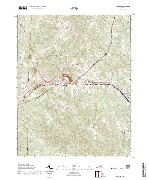
2022 Map of Crewe West
USGS Topo · Published 2022About this map
Burkeville serves as the central hub of this Southside Virginia landscape, where modern highway corridors intersect older local routes. The geography is defined by a dense network of tributaries including Lazaretto Cr, Saylers Cr, and the Little Nottoway River, which carve through the terrain between Burkes Tavern and the western edge of Crewe. This era shows a community deeply rooted in its family lands, evidenced by the numerous small burial grounds scattered throughout the quadrangle, such as Cook Cem, Vaughns Cem, and Thomas Cem. The conversion of older rail infrastructure is visible in the High Bridge Trl, which follows the historic railroad grade through the northwest. Meanwhile, rural life persists along named roads like Old Plank Rd and Raccoon Crossing Rd, preserving the traditional settlement patterns of Nottoway and Prince Edward counties.
Find a feature on this map
99 named features on this map. Tap any name to fly to it.
Don’t see what you’re looking for? This feature index may not catch every label — zoom into the map to look around manually.
Map Details
Editions of this 2022 Crewe West Map
This is the sole edition of this map. No revisions or reprints were ever made.
Other maps of this area

1891 · Farmville
USGS Topo · 1:125,000

1893 · Farmville
USGS Topo · 1:125,000

1947 · Roanoke
USGS Topo · 1:250,000

1958 · Farmville
USGS Topo · 1:62,500

1958 · Jetersville
USGS Topo · 1:62,500

1958 · Crewe
USGS Topo · 1:62,500

1958 · Keysville
USGS Topo · 1:62,500

1959 · Roanoke
USGS Topo · 1:250,000

1963 · Roanoke
USGS Topo · 1:250,000
1968 · Deatonville
USGS Topo · 1:24,000