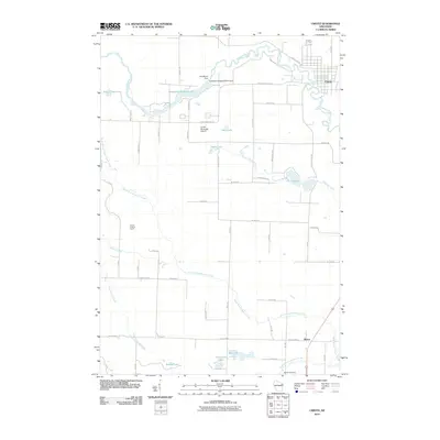
2010 Map of Crivitz
USGS Topo · Published 2010About this map
Crivitz and Beaver anchor this section of Marinette County, where the industrial and recreational legacy of the Peshtigo River is on full display. The river's power is harnessed at the Sandstone Dam and the Sandstone Rapids WP214 Dam, creating the wide waters of Sandstone Reservoir 675. The landscape transitions from these engineered waterways to a network of natural glacial lakes and creeks, including Marl Lake, Devils Lake, and Left Foot Lake. Significant local landmarks provide points of reference for researchers, from the Crivitz Municipal Airport near the center of the quadrangle to the Beaver Lookout Tower on the western heights. The southern reaches of the map are defined by the convergence of several waterways, including North Branch Beaver Creek and South Branch Beaver Creek, while the Beaver Cemetery serves as a vital touchstone for genealogical study in the area.
Find a feature on this map
59 named features on this map. Tap any name to fly to it.
Don’t see what you’re looking for? This feature index may not catch every label — zoom into the map to look around manually.
Map Details
Editions of this 2010 Crivitz Map
This is the sole edition of this map. No revisions or reprints were ever made.
Other maps of this area

1939 · Porterfield
USGS Topo · 1:48,000

1940 · Athelstane
USGS Topo · 1:48,000

1941 · Coleman
USGS Topo · 1:48,000

1942 · Athelstane
USGS Topo · 1:48,000

1942 · Coleman
USGS Topo · 1:48,000

1942 · Porterfield
USGS Topo · 1:48,000

1942 · Wausaukee
USGS Topo · 1:48,000

1947 · Wausaukee
USGS Topo · 1:48,000

1950 · Coleman
USGS Topo · 1:48,000

1954 · Iron Mountain
USGS Topo · 1:250,000