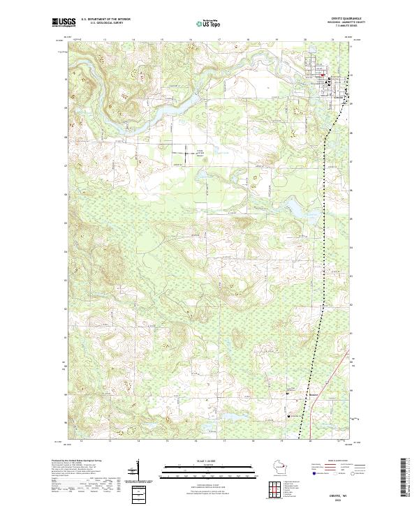
2022 Map of Crivitz
USGS Topo · Published 2022About this map
The Peshtigo River winds through the northeast corner of this Marinette County landscape, anchoring the village of Crivitz. This modern survey reflects a settlement pattern defined by proximity to several glacial lakes, including Marl Lake, Devils Lake, and Left Foot Lake. Genealogists will find a concentration of burial sites clustered near the village, such as Forest Home Cem Old and Saint Marys Catholic Cem New. To the south, the community of Beaver marks a secondary hub of activity, surrounded by an extensive network of wetlands and creeks. The terrain is notably water-rich, featuring numerous family-named landmarks and watercourses like Murphy Cr and N Br Beaver Cr that drain the timbered plains. Transportation is represented by the Crivitz Municipal Airport and a grid of county highways and local lanes that connect these rural outposts.
Find a feature on this map
88 named features on this map. Tap any name to fly to it.
Don’t see what you’re looking for? This feature index may not catch every label — zoom into the map to look around manually.
Map Details
Editions of this 2022 Crivitz Map
This is the sole edition of this map. No revisions or reprints were ever made.
Other maps of this area

1939 · Porterfield
USGS Topo · 1:48,000

1940 · Athelstane
USGS Topo · 1:48,000

1941 · Coleman
USGS Topo · 1:48,000

1942 · Athelstane
USGS Topo · 1:48,000

1942 · Coleman
USGS Topo · 1:48,000

1942 · Porterfield
USGS Topo · 1:48,000

1942 · Wausaukee
USGS Topo · 1:48,000

1947 · Wausaukee
USGS Topo · 1:48,000

1950 · Coleman
USGS Topo · 1:48,000

1954 · Iron Mountain
USGS Topo · 1:250,000