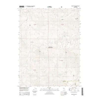
2015 Map of Crockett Peak
USGS Topo · Published 2015About this map
Crockett Peak and the surrounding high country of the Mendocino National Forest define this landscape along the boundary of Lake and Colusa counties. The terrain is marked by significant elevation changes, from the depths of the Eel River drainage to the heights of Snow Mountain and Signal Peak. Local nomenclature reflects a rugged history of the region, including curiously named spots like the Kneecap Cabbage Patch and Bloody Rock.
Find a feature on this map
34 named features on this map. Tap any name to fly to it.
Don’t see what you’re looking for? This feature index may not catch every label — zoom into the map to look around manually.
Map Details
Editions of this 2015 Crockett Peak Map
This is the sole edition of this map. No revisions or reprints were ever made.
Other maps of this area

1919 · Elk Creek
USGS Topo · 1:62,500

1922 · Hullville
USGS Topo · 1:62,500

1948 · Elk Creek
USGS Topo · 1:62,500

1951 · Lake Pillsbury
USGS Topo · 1:62,500

1951 · Stonyford
USGS Topo · 1:62,500

1952 · Hull Mountain
USGS Topo · 1:62,500

1957 · Elk Creek
USGS Topo · 1:62,500

1957 · Ukiah
USGS Topo · 1:250,000

1960 · Ukiah
USGS Topo · 1:250,000
1967 · Lake Pillsbury
USGS Topo · 1:24,000