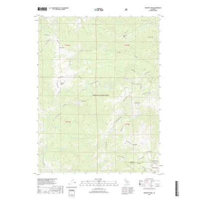
2018 Map of Crockett Peak
USGS Topo · Published 2018About this map
Mendocino National Forest encompasses this high-elevation wilderness where the headwaters of the Eel River and Middle Fork Stony Creek originate. The topography is defined by prominent landforms like Crockett Peak and the southern slopes of Snow Mountain, which straddles the boundary between Lake Co and Colusa Co. This territory reflects a landscape managed for both timber and recreation, characterized by an extensive system of ridge-line paths and forest roads.
Find a feature on this map
49 named features on this map. Tap any name to fly to it.
Don’t see what you’re looking for? This feature index may not catch every label — zoom into the map to look around manually.
Map Details
Editions of this 2018 Crockett Peak Map
This is the sole edition of this map. No revisions or reprints were ever made.
Other maps of this area

1919 · Elk Creek
USGS Topo · 1:62,500

1922 · Hullville
USGS Topo · 1:62,500

1948 · Elk Creek
USGS Topo · 1:62,500

1951 · Lake Pillsbury
USGS Topo · 1:62,500

1951 · Stonyford
USGS Topo · 1:62,500

1952 · Hull Mountain
USGS Topo · 1:62,500

1957 · Elk Creek
USGS Topo · 1:62,500

1957 · Ukiah
USGS Topo · 1:250,000

1960 · Ukiah
USGS Topo · 1:250,000
1967 · Lake Pillsbury
USGS Topo · 1:24,000