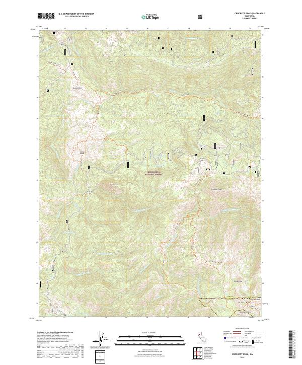
2021 Map of Crockett Peak
USGS Topo · Published 2021About this map
Crockett Peak and the high ridges of the Mendocino National Forest dominate this landscape on the boundary of Lake and Colusa counties. This 2021 survey details a complex network of backcountry routes, including the Milk Ranch Loop Trl and Rattlesnake 4x4 Trl, which navigate the steep transition between the Eel River drainage and the Middle Fork Stony Cr headwaters. Notable peaks like Snow Mtn and Signal Peak anchor the southern portion of the sheet, while unique landmarks such as Bloody Rock and Skeleton Glade suggest the deep local lore of these California highlands. The map provides contemporary topographical detail of remote springs like Twin Springs and the convergence of numerous seasonal creeks, illustrating the hydrological significance of the Anderson Ridge and Peavine Ridge systems.
Find a feature on this map
43 named features on this map. Tap any name to fly to it.
Don’t see what you’re looking for? This feature index may not catch every label — zoom into the map to look around manually.
Map Details
Editions of this 2021 Crockett Peak Map
This is the sole edition of this map. No revisions or reprints were ever made.
Other maps of this area

1919 · Elk Creek
USGS Topo · 1:62,500

1922 · Hullville
USGS Topo · 1:62,500

1948 · Elk Creek
USGS Topo · 1:62,500

1951 · Lake Pillsbury
USGS Topo · 1:62,500

1951 · Stonyford
USGS Topo · 1:62,500

1952 · Hull Mountain
USGS Topo · 1:62,500

1957 · Elk Creek
USGS Topo · 1:62,500

1957 · Ukiah
USGS Topo · 1:250,000

1960 · Ukiah
USGS Topo · 1:250,000
1967 · Lake Pillsbury
USGS Topo · 1:24,000