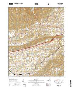
2019 Map of Crockett
USGS Topo · Published 2019About this map
Crockett and its surrounding hamlets occupy the valleys of Wythe County, where the southern foothills of the Jefferson National Forest meet the winding course of Reed Creek. This topographic record illustrates a landscape defined by long-standing mountain ridges like Little Walker Mtn and the Seven Sisters, which constrain the movement of local traffic and settlement patterns. A network of rural routes, including the Grayson Tpke and Old Stage Rd, connects small communities such as Groseclose, Wilson, and Blessing.
Find a feature on this map
93 named features on this map. Tap any name to fly to it.
Don’t see what you’re looking for? This feature index may not catch every label — zoom into the map to look around manually.
Map Details
Editions of this 2019 Crockett Map
This is the sole edition of this map. No revisions or reprints were ever made.
Other maps of this area

1887 · Pocahontas
USGS Topo · 1:125,000

1889 · Wytheville
USGS Topo · 1:125,000

1891 · Pocahontas
USGS Topo · 1:125,000

1892 · Wytheville
USGS Topo · 1:125,000

1894 · Pocahontas
USGS Topo · 1:125,000

1895 · Pocahontas
USGS Topo · 1:125,000

1930 · Speedwell
USGS Topo · 1:62,500

1931 · Rural Retreat
USGS Topo · 1:48,000

1935 · Cedar Springs
USGS Topo · 1:24,000
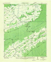
1935 · Garden Mountain
USGS Topo · 1:24,000