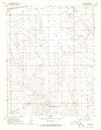
1968 Map of Croft
USGS Topo · Published 1970About this map
The South Fork Ninnescah River and its tributaries, such as Turkey Creek, define the rolling prairie landscape of Pratt County during the late 1960s. This agricultural region is anchored by the small settlements of Cullison, Springvale, and Croft, which reflect the area's rural development and township organization across Banner, Richland, and Grant. The map captures a critical period for transportation and infrastructure, showing the crossing of two major railroads: the Chicago Rock Island and Pacific in the north and the Atchison Topeka and Santa Fe traversing the southern townships. Local history is preserved through the location of several burial grounds, including Sunset Cem and Jenkins Cem, while the presence of scattered Gravel Pits and pipelines suggests the local industrial activity and resource extraction of the era.
Find a feature on this map
20 named features on this map. Tap any name to fly to it.
Don’t see what you’re looking for? This feature index may not catch every label — zoom into the map to look around manually.
Map Details
Editions of this 1968 Croft Map
This is the sole edition of this map. No revisions or reprints were ever made.
Other maps of this area

1889 · Kinsley
USGS Topo · 1:125,000

1891 · Medicine Lodge
USGS Topo · 1:125,000

1892 · Kinsley
USGS Topo · 1:125,000

1892 · Coldwater
USGS Topo · 1:125,000

1892 · Pratt
USGS Topo · 1:125,000

1893 · Medicine Lodge
USGS Topo · 1:125,000

1894 · Kinsley
USGS Topo · 1:125,000

1894 · Pratt
USGS Topo · 1:125,000

1955 · Pratt
USGS Topo · 1:250,000

1959 · Pratt
USGS Topo · 1:250,000