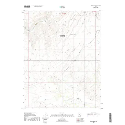
2020 Map of Cross Canyon
USGS Topo · Published 2020About this map
Canyonlands National Park encompasses a complex desert landscape where the Colorado River carves through Cataract Canyon, marking the border between Garfield and San Juan counties. This 2020 survey details the intricate drainage networks of Deep Canyon, Cow Canyon, and Red Lake Canyon as they descend toward the river. To the south, the topography shifts into broader, high-altitude flats and basins, including Beef Basin, Bull Valley, and the appropriately named Ruin Park. This area is connected by a network of rugged 4WD routes such as Bobbys Hole Road and Devils Lane, which provide access to unique landmarks like Horsehoof Arch and the secluded Pappys Pasture. The map highlights a transition from vertical canyon walls to the grazing and archaeological landscapes of the Needles district, providing a clear view of the relationship between prehistoric land use and modern recreational access.
Find a feature on this map
29 named features on this map. Tap any name to fly to it.
Don’t see what you’re looking for? This feature index may not catch every label — zoom into the map to look around manually.
Map Details
Editions of this 2020 Cross Canyon Map
This is the sole edition of this map. No revisions or reprints were ever made.
Other maps of this area

1885 · San Rafael
USGS Topo · 1:250,000

1885 · La Sal
USGS Topo · 1:250,000

1886 · Henry Mountains
USGS Topo · 1:250,000

1886 · Abajo
USGS Topo · 1:250,000

1892 · Abajo
USGS Topo · 1:250,000

1892 · Henry Mountains
USGS Topo · 1:250,000

1893 · Abajo
USGS Topo · 1:250,000

1935 · Elk Ridge
USGS Topo · 1:96,000

1940 · Elk Ridge
USGS Topo · 1:125,000

1952 · Mouth of Dark Canyon
USGS Topo · 1:62,500