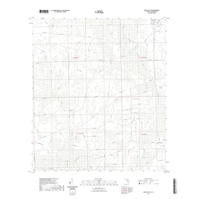
2021 Map of Cross City SW
USGS Topo · Published 2021About this map
Pumpkin Swamp dominates the northern interior of this Gulf Coast landscape, giving way to a network of local roads and water bodies as the terrain descends toward the coast. The settlement patterns reflect the rural character of Dixie County, with the southern periphery of Cross City visible in the northeast corner. Notable landmarks include the Sandhill Cem, which serves as a significant point for genealogical research in this sparsely populated area. To the south, the environment transitions into the heavy wetlands of California Swamp and Davis Island. The hydrology is defined by the slow-moving Fishhole Cr and the secluded Station Lake, illustrating the complex drainage system of the Florida Big Bend region. This survey captures a moment of modern accessibility through thoroughfare routes like Horseshoe Rd and the SW 351 Hwy, which navigate the otherwise dense swampy terrain.
Find a feature on this map
98 named features on this map. Tap any name to fly to it.
Don’t see what you’re looking for? This feature index may not catch every label — zoom into the map to look around manually.
Map Details
Editions of this 2021 Cross City SW Map
This is the sole edition of this map. No revisions or reprints were ever made.
Other maps of this area

1954 · Cross City West
USGS Topo · 1:24,000

1954 · Eugene
USGS Topo · 1:24,000

1954 · Cross City East
USGS Topo · 1:24,000

1954 · Jena
USGS Topo · 1:24,000

1954 · Steinhatchee SE
USGS Topo · 1:24,000

1954 · Cross City SW
USGS Topo · 1:24,000

1954 · Horseshoe Beach
USGS Topo · 1:24,000

1954 · Vista
USGS Topo · 1:24,000

1954 · Gainesville
USGS Topo · 1:250,000

1955 · Shired Island
USGS Topo · 1:24,000