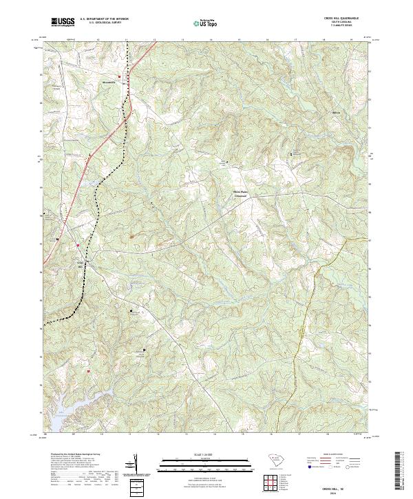
2024 Map of Cross Hill
USGS Topo · Published 2024About this map
Cross Hill serves as a primary hub for this section of South Carolina, situated at the intersection of several local routes that connect the township to Mountville and White Plains Crossroad. The landscape is defined by the headwaters of numerous creeks, including Little River, Mudlick Creek, and Campbell Creek, which flow southward toward Lake Greenwood. This topography of small valleys and ridges is heavily marked by family and community history, evidenced by the high density of rural burial sites such as Piedmont Graveyard, Head Springs Cem, and the Bethabara Church Graveyard. Aviation history is represented by Thomason Airfield north of Mountville, while the southern boundary of the map follows the winding Laurens Co and Newberry Co line. Small water features like Hollingworths Pond and the branching segments of North Campbell Creek illustrate the historical importance of local water sources to these agrarian communities.
Find a feature on this map
79 named features on this map. Tap any name to fly to it.
Don’t see what you’re looking for? This feature index may not catch every label — zoom into the map to look around manually.
Map Details
Editions of this 2024 Cross Hill Map
This is the sole edition of this map. No revisions or reprints were ever made.
Other maps of this area

1892 · Abbeville
USGS Topo · 1:125,000

1941 · Spartanburg
USGS Topo · 1:250,000

1949 · Ninety-Six
USGS Topo · 1:24,000

1953 · Spartanburg
USGS Topo · 1:250,000

1954 · Greenville
USGS Topo · 1:250,000

1958 · Greenville
USGS Topo · 1:250,000

1960 · Spartanburg
USGS Topo · 1:250,000

1963 · Spartanburg
USGS Topo · 1:250,000

1964 · Spartanburg
USGS Topo · 1:250,000
1970 · Bush River
USGS Topo · 1:24,000