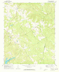
1970 Map of Cross Hill
USGS Topo · Published 1973About this map
Cross Hill serves as a central hub in this Upstate South Carolina landscape, where the Seaboard Coast Line railroad dictates the local geography. The rail line connects the settlement of Mountville in the north to Cross Hill, passing by Midway Sch and specialized track sections like the 3 Tracks junction. The terrain is defined by a dense network of waterways including the Little River, Mudlick Creek, and Watkins Creek, which flow toward the southern edge of the map where the shoreline of Lake Greenwood begins to emerge.
Find a feature on this map
21 named features on this map. Tap any name to fly to it.
Don’t see what you’re looking for? This feature index may not catch every label — zoom into the map to look around manually.
Map Details
Editions of this 1970 Cross Hill Map
This is the sole edition of this map. No revisions or reprints were ever made.
Other maps of this area

1892 · Abbeville
USGS Topo · 1:125,000

1941 · Spartanburg
USGS Topo · 1:250,000

1949 · Ninety-Six
USGS Topo · 1:24,000

1953 · Spartanburg
USGS Topo · 1:250,000

1954 · Greenville
USGS Topo · 1:250,000

1958 · Greenville
USGS Topo · 1:250,000

1960 · Spartanburg
USGS Topo · 1:250,000

1963 · Spartanburg
USGS Topo · 1:250,000

1964 · Spartanburg
USGS Topo · 1:250,000
1970 · Bush River
USGS Topo · 1:24,000