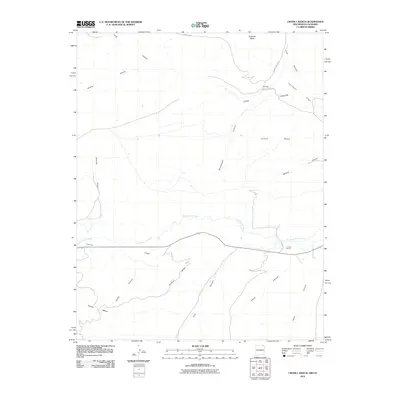
2010 Map of Cross L Ranch
USGS Topo · Published 2010About this map
The Dry Cimarron River winds through a landscape of high tablelands and deep-cut drainages along the New Mexico and Colorado border. The namesake Cross L Ranch sits near the riverbanks, marking a long-standing ranching presence in this high-desert environment. To the north and south, the terrain is defined by prominent landforms such as Hardesty Mesa, Island Mesa, and River Mesa, which rise above a network of canyons including Long Canyon, Cow Canyon, and Duncan Canyon.
Find a feature on this map
23 named features on this map. Tap any name to fly to it.
Don’t see what you’re looking for? This feature index may not catch every label — zoom into the map to look around manually.
Map Details
Editions of this 2010 Cross L Ranch Map
This is the sole edition of this map. No revisions or reprints were ever made.
Other maps of this area

1891 · Mesa De Maya
USGS Topo · 1:125,000

1893 · Mesa de Maya
USGS Topo · 1:125,000

1954 · Dalhart
USGS Topo · 1:250,000

1955 · La Junta
USGS Topo · 1:250,000

1958 · La Junta
USGS Topo · 1:250,000

1958 · Dalhart
USGS Topo · 1:250,000

1962 · Dalhart
USGS Topo · 1:250,000

1968 · La Junta
USGS Topo · 1:250,000
1972 · Branson SE
USGS Topo · 1:24,000

1972 · Emery Peak
USGS Topo · 1:24,000