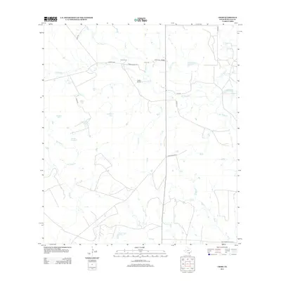
2013 Map of Cross
USGS Topo · Published 2013About this map
The settlement of Cross and its neighboring Cross Cem lie at the center of this rural McMullen County landscape, where ranching and water management define the geography. The terrain is intricately carved by intermittent waterways such as San Miguel Cr and Bill Walker Cr, which feed into a network of livestock tanks and engineered reservoirs. Notable among these are Wheeler Lake Number 1 and Wheeler Lake Number 2, alongside numerous family-named landmarks like Franklin Ranch. The prevalence of named catchments, including Lone Star Tank and Beulah Tank, reflects a landscape adapted for cattle operations in a region where water is a vital resource. Roadways such as Green Franklin Rd and Yeager Rd connect these dispersed ranching outposts across the brush-country of South Texas.
Find a feature on this map
32 named features on this map. Tap any name to fly to it.
Don’t see what you’re looking for? This feature index may not catch every label — zoom into the map to look around manually.
Map Details
Editions of this 2013 Cross Map
This is the sole edition of this map. No revisions or reprints were ever made.
Other maps of this area

1920 · Mikeska
USGS Topo · 1:125,000

1925 · Tilden No. 1
USGS Topo · 1:48,000

1925 · Crowther No. 3
USGS Topo · 1:48,000

1925 · Simmons No. 2
USGS Topo · 1:48,000

1929 · Simmons
USGS Topo · 1:62,500

1930 · Tilden
USGS Topo · 1:62,500

1930 · Whitsett
USGS Topo · 1:62,500

1942 · Tilden
USGS Topo · 1:62,500

1942 · Whitsett
USGS Topo · 1:62,500

1953 · Crystal City
USGS Topo · 1:250,000