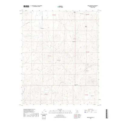
2018 Map of Cross Mountain
USGS Topo · Published 2018About this map
Sierra Nevada and Mojave Desert ecological systems meet in this high-altitude topographic study, where the Pacific Crest National Scenic Trail winds through the southwestern corner of the quadrangle. The landscape is defined by dramatic elevation changes, rising from the Antimony Flat to prominent peaks such as Cross Mtn, White Mtn, and Toms Hill. This 2018 survey captures the intricate network of canyons and summits, including Hoffman Summit and Little Jawbone Canyon. In the northwest, the relatively level Kelso Valley provides a corridor for S Kelso Valley Rd, which connects with Jawbone Canyon Rd. Water sources are sparse but notable, with Braitman Spring and the drainage of Cottonwood Cr marking the arid terrain.
Find a feature on this map
21 named features on this map. Tap any name to fly to it.
Don’t see what you’re looking for? This feature index may not catch every label — zoom into the map to look around manually.
Map Details
Editions of this 2018 Cross Mountain Map
This is the sole edition of this map. No revisions or reprints were ever made.
Other maps of this area

1915 · Mojave
USGS Topo · 1:125,000

1943 · Tehachapi
USGS Topo · 1:62,500

1943 · Cross Mountain
USGS Topo · 1:62,500

1943 · Emerald Mtn
USGS Topo · 1:62,500

1943 · Mojave
USGS Topo · 1:62,500

1948 · Bakersfield
USGS Topo · 1:250,000

1955 · Bakersfield
USGS Topo · 1:250,000

1956 · Bakersfield
USGS Topo · 1:250,000
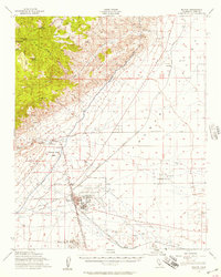
1956 · Mojave
USGS Topo · 1:62,500

1960 · Bakersfield
USGS Topo · 1:250,000