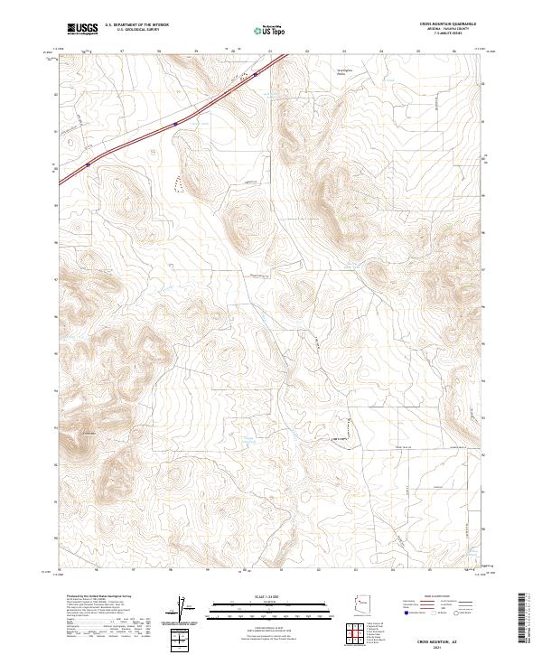
2021 Map of Cross Mountain
USGS Topo · Published 2021About this map
Cross Mtn and the sweeping expanse of the Seventyfour Plains define this Yavapai County landscape, where modern road names often hint at the backcountry character of the high desert. This 2021 survey illustrates a region where water management remains the primary evidence of land use, marked by numerous livestock tanks named for local figures such as Shorty Davis Tank, Jack Webb Tank, and Hoggy John Tank. These scattered water sources are critical features in an arid environment drained by Trout Cr and the deep contours of Dividing Canyon. The map reveals a network of rural routes and descriptive trails, including Broken Shovel Trl, Walkabout Trl, and Young Trail Rd, which navigate the township lines of T21N and T22N.
Find a feature on this map
29 named features on this map. Tap any name to fly to it.
Don’t see what you’re looking for? This feature index may not catch every label — zoom into the map to look around manually.
Map Details
Editions of this 2021 Cross Mountain Map
This is the sole edition of this map. No revisions or reprints were ever made.
Other maps of this area

1886 · Diamond Creek
USGS Topo · 1:250,000

1892 · Diamond Creek
USGS Topo · 1:250,000

1948 · Williams
USGS Topo · 1:250,000

1954 · Williams
USGS Topo · 1:250,000

1956 · Williams
USGS Topo · 1:250,000

1960 · Williams
USGS Topo · 1:250,000

1961 · Williams
USGS Topo · 1:250,000
1980 · Fort Rock Ranch
USGS Topo · 1:24,000
1980 · Anvil Rock Ranch
USGS Topo · 1:24,000
1980 · Anvil Rock
USGS Topo · 1:24,000