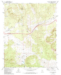
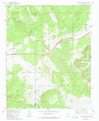
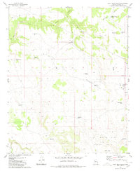
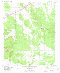
1980 Map of Fort Rock Ranch
USGS Topo · Published 1980About this map
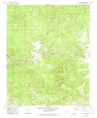
Fort Rock Ranch serves as a primary landmark in this high-desert landscape of northwestern Arizona, situated along the Mohave and Yavapai County line. The 1980 edition documents a region defined by water management and ranching operations, featuring a complex network of tanks and small lakes such as Tom Bacon Lake, Horse Lake, and Meadow Lake. Genealogists and local historians can locate specific sites of human activity including a Cemetery and a Grave near the ranch headquarters, along with various Ruins scattered near the Three Sisters landform. The presence of a Landing Strip, a Radio Tower, and multiple Pipelines highlights the modern infrastructure supporting this remote area, while historic Jeep Trails and a Lookout suggest the enduring importance of navigation through the hills and washes.
Find a feature on this map
34 named features on this map. Tap any name to fly to it.
Don’t see what you’re looking for? This feature index may not catch every label — zoom into the map to look around manually.
Map Details
Editions of this 1980 Fort Rock Ranch Map
2 editions found
Other maps of this area

1886 · Diamond Creek
USGS Topo · 1:250,000

1892 · Diamond Creek
USGS Topo · 1:250,000

1948 · Williams
USGS Topo · 1:250,000

1954 · Williams
USGS Topo · 1:250,000

1956 · Williams
USGS Topo · 1:250,000

1960 · Williams
USGS Topo · 1:250,000

1961 · Williams
USGS Topo · 1:250,000
1980 · Anvil Rock Ranch
USGS Topo · 1:24,000
1980 · Cross Mountain
USGS Topo · 1:24,000
1980 · Bull Spring
USGS Topo · 1:24,000