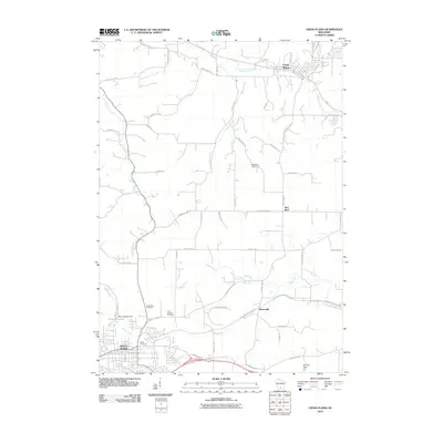
2010 Map of Cross Plains
USGS Topo · Published 2010About this map
Mount Horeb anchors the southwest corner of this Dane County landscape, where the town’s street grid meets the winding headwaters of Moen Creek. This 2010 survey illustrates a region defined by its hydrology and scientific infrastructure, notably the Pine Bluff Observatory situated on a high point above Pine Bluff. The drainage patterns of the Sugar River and Black Earth Creek dictate the local geography, punctuated by small rural settlements like Klevenville and Cross Plains. Genealogists and local historians can locate several key burial sites, including Saint Ignatius Cemetery and the North Side Cemetery. The presence of the Military Ridge State Trl follows an established corridor through the undulating terrain, while features like Stewart Lake 2 and the Brunner Dam highlight the managed water resources of the early 21st century.
Find a feature on this map
51 named features on this map. Tap any name to fly to it.
Don’t see what you’re looking for? This feature index may not catch every label — zoom into the map to look around manually.
Map Details
Editions of this 2010 Cross Plains Map
This is the sole edition of this map. No revisions or reprints were ever made.
Other maps of this area

1907 · Cross Plains
USGS Topo · 1:62,500

1909 · Cross Plains
USGS Topo · 1:62,500

1920 · Blue Mounds
USGS Topo · 1:62,500

1922 · Blue Mounds
USGS Topo · 1:62,500

1923 · Blanchardville
USGS Topo · 1:62,500

1923 · New Glarus
USGS Topo · 1:62,500

1954 · Rockford
USGS Topo · 1:250,000

1955 · Rockford
USGS Topo · 1:250,000

1957 · Madison
USGS Topo · 1:250,000

1958 · Rockford
USGS Topo · 1:250,000