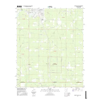
2017 Map of Crossett South
USGS Topo · Published 2017About this map
Crossett serves as the focal point of this region where the Arkansas timberlands meet the Louisiana state line. The map details the grid of the town center, including several tree-named streets like Oak St and Beech St, alongside the outlying communities of West Crossett and South Crossett. To the south, the landscape becomes increasingly defined by the hydrology of the coastal plain, with the winding paths of Snake Cr, Williamson Cr, and Indian Cr draining towards the border.
Find a feature on this map
118 named features on this map. Tap any name to fly to it.
Don’t see what you’re looking for? This feature index may not catch every label — zoom into the map to look around manually.
Map Details
Editions of this 2017 Crossett South Map
This is the sole edition of this map. No revisions or reprints were ever made.
Other maps of this area

1934 · Felsenthal
USGS Topo · 1:62,500

1935 · Naff
USGS Topo · 1:62,500

1935 · Haile
USGS Topo · 1:62,500

1937 · Felsenthal
USGS Topo · 1:62,500

1938 · Felsenthal
USGS Topo · 1:62,500

1939 · Felsenthal
USGS Topo · 1:62,500

1953 · Greenwood
USGS Topo · 1:250,000

1953 · El Dorado
USGS Topo · 1:250,000

1955 · Jackson
USGS Topo · 1:250,000

1955 · Shreveport
USGS Topo · 1:250,000