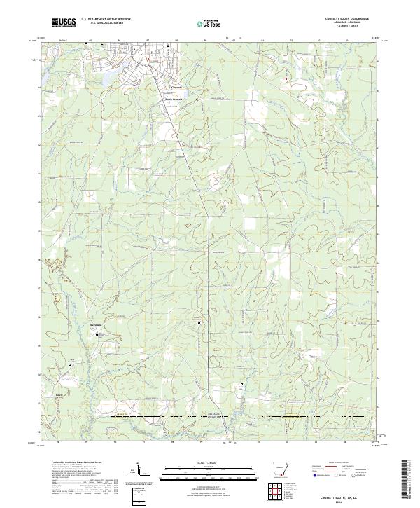
2024 Map of Crossett South
USGS Topo · Published 2024About this map
The northern edge of the Arkansas-Louisiana state line anchors this survey, showing the transition from the organized street grids of Crossett and South Crossett into the rural timberlands and creek bottoms of Ashley County. A network of watercourses, including the winding Snake Creek and Jackson Creek, defines the local geography, providing natural drainage across the southern reaches of the state. The town plan for Crossett is particularly detailed, featuring streets named after native trees like Pine St, Oak St, and Hickory St.
Find a feature on this map
130 named features on this map. Tap any name to fly to it.
Don’t see what you’re looking for? This feature index may not catch every label — zoom into the map to look around manually.
Map Details
Editions of this 2024 Crossett South Map
This is the sole edition of this map. No revisions or reprints were ever made.
Other maps of this area

1934 · Felsenthal
USGS Topo · 1:62,500

1935 · Naff
USGS Topo · 1:62,500

1935 · Haile
USGS Topo · 1:62,500

1937 · Felsenthal
USGS Topo · 1:62,500

1938 · Felsenthal
USGS Topo · 1:62,500

1939 · Felsenthal
USGS Topo · 1:62,500

1953 · Greenwood
USGS Topo · 1:250,000

1953 · El Dorado
USGS Topo · 1:250,000

1955 · Jackson
USGS Topo · 1:250,000

1955 · Shreveport
USGS Topo · 1:250,000