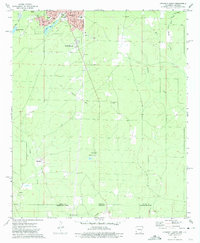
1973 Map of Crossett South
USGS Topo · Published 1975About this map
Crossett serves as the focal point for this survey of south-central Arkansas, where the developed streets of the town transition into the rural timberlands and creek bottoms of the Louisiana borderlands. Local neighborhood names like South Crossett appear alongside institutional landmarks such as Norman Sch, Anderson Sch, and the Western Cem. The map documents the specific layout of the town's south side, including a dense grid of residential streets from Virginia St to Waterwell Rd, and follows the state line where Ashley County meets Morehouse Parish.
Find a feature on this map
40 named features on this map. Tap any name to fly to it.
Don’t see what you’re looking for? This feature index may not catch every label — zoom into the map to look around manually.
Map Details
Editions of this 1973 Crossett South Map
This is the sole edition of this map. No revisions or reprints were ever made.
Other maps of this area

1934 · Felsenthal
USGS Topo · 1:62,500

1935 · Naff
USGS Topo · 1:62,500

1935 · Haile
USGS Topo · 1:62,500

1937 · Felsenthal
USGS Topo · 1:62,500

1938 · Felsenthal
USGS Topo · 1:62,500

1939 · Felsenthal
USGS Topo · 1:62,500

1953 · Greenwood
USGS Topo · 1:250,000

1953 · El Dorado
USGS Topo · 1:250,000

1955 · Jackson
USGS Topo · 1:250,000

1955 · Shreveport
USGS Topo · 1:250,000