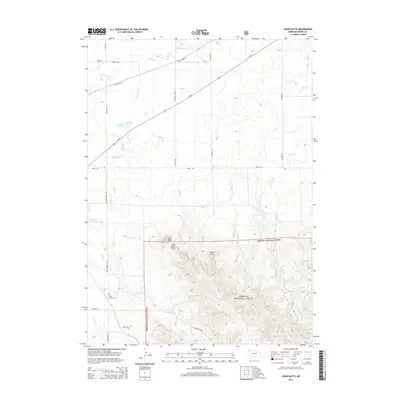
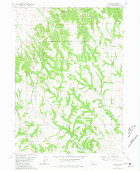
2014 Map of Crow Butte
USGS Topo · Published 2014About this map
The Nebraska National Forest dominates the southern reaches of this Dawes County landscape, where the dramatic rises of Crow Butte, Little Crow Butte, and Crown Butte define the local topography. This 2014 survey captures a rural ranching and forest environment interlaced with family-named landmarks and water infrastructure. The White River meanders across the northern section, while the western half features a series of managed water bodies including Souther Reservoir, Alcorn Reservoir, and the Squaw Cr Reservoir. Local history is anchored by the Crow Butte Cem near the confluence of English Cr and Squaw Cr. Modern transportation follows the path of Us-20 and its predecessor, Old Highway 20, cutting a diagonal path through the high plains. A network of section-line roads like Whitney Lake Rd and Hartman Rd provides access to the isolated homesteads and forest tracts of the Nebraska Panhandle.
Find a feature on this map
30 named features on this map. Tap any name to fly to it.
Don’t see what you’re looking for? This feature index may not catch every label — zoom into the map to look around manually.
Map Details
Editions of this 2014 Crow Butte Map
This is the sole edition of this map. No revisions or reprints were ever made.
Other maps of this area

1955 · Alliance
USGS Topo · 1:250,000

1957 · Alliance
USGS Topo · 1:250,000

1958 · Alliance
USGS Topo · 1:250,000

1980 · Horn
USGS Topo · 1:24,000

1980 · Crow Butte
USGS Topo · 1:24,000
1980 · Coffee Mill Butte SW
USGS Topo · 1:24,000

1980 · Dead Mans Creek
USGS Topo · 1:24,000
1980 · Trunk Butte
USGS Topo · 1:24,000
1980 · Chimney Butte
USGS Topo · 1:24,000
1980 · Belmont
USGS Topo · 1:24,000