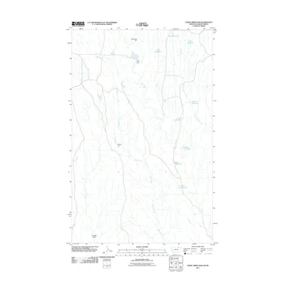
2011 Map of Crow Creek Dam
USGS Topo · Published 2011About this map
Crow Creek Dam and its surrounding watershed define this portion of Valley County, Montana, just south of the Saskatchewan border. The landscape is characterized by a high concentration of small-scale water management features, including several named earthen structures such as Chamberlain Dam and Barney Dam. These diversions and reservoirs, including Timber Reservoir, Time Reservoir, and Quick Reservoir, indicate an intensely managed agricultural or ranching environment where water security is paramount. The topography follows the drainage of Snake Creek and Crow Creek, eventually leading toward the Red Mud Coulee in the south. The mapping of many small, often family-named reservoirs like Grimes Reservoir and Ardis Reservoir provides a detailed look at the local land use and hydrology of the northeastern Montana plains in the early 21st century.
Find a feature on this map
15 named features on this map. Tap any name to fly to it.
Don’t see what you’re looking for? This feature index may not catch every label — zoom into the map to look around manually.
Map Details
Editions of this 2011 Crow Creek Dam Map
This is the sole edition of this map. No revisions or reprints were ever made.
Other maps of this area

1954 · Glasgow
USGS Topo · 1:250,000

1957 · Glasgow
USGS Topo · 1:250,000

1958 · Glasgow
USGS Topo · 1:250,000

1984 · Thoeny Hills East
USGS Topo · 1:24,000

1984 · Snake Creek School
USGS Topo · 1:24,000

1984 · Black Calf Reservoir
USGS Topo · 1:24,000

1984 · Coulter Coulee
USGS Topo · 1:24,000

1984 · Dead Horse Coulee
USGS Topo · 1:24,000

1984 · Crow Creek Dam
USGS Topo · 1:24,000
2011 · Black Calf Reservoir
USGS Topo · 1:24,000